Preventing the spark: how can rural areas respond to the UK’s rising wildfire risk?
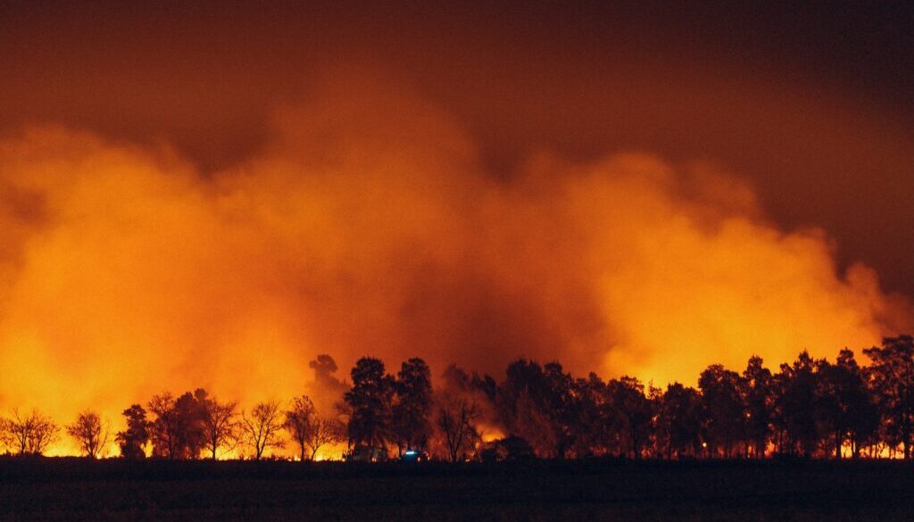
Wildfire activity in the UK has risen in recent years, with the Global Wildfire Information System (GWIS) recording 47,879 hectares burned across 181 sites in 2025 – the highest annual total since monitoring began in 2012 – and surpassing the previous annual record set in 2019. While many recorded incidents are linked to human activity, periods of hotter and drier weather are contributing to conditions in which fires can spread more rapidly. These trends are prompting renewed attention as to how rural areas anticipate and plan for wildfire events, and what this means for land use, local economies and public services. Against this backdrop, some key questions emerge: how should rural areas respond to rising wildfire risk, and what does long‑term resilience require? Jessica Sellick investigates.
Fires have been part of landscape management and maintenance for centuries, and are seen as an essential process in some ecosystems for renewing vegetation or controlling pests. Wildfires, on the other hand, are uncontrolled vegetation fires. They are surprisingly common in the UK, but their scale and visibility have increased in recent years, with incidents recorded across vast swathes of rural England and an unprecedented number in urban locations. Indeed, Fire and Rescue Services report shifts in the timing, location and complexity of the wildfire incidents they are responding to – with data indicating that 2025 saw the largest area burned since systematic monitoring began in 2012. These developments are prompting rural communities, businesses and public bodies to consider how wildfire risk is assessed, planned for and managed. Against this backdrop, key questions emerge: what approach should rural areas take in the face of increasing wildfire risk, and what capabilities, investments and actions are essential for long-term resilience?
What are wildfires and how is the UK risk changing?
The UK Government defines a wildfire as ‘an uncontrolled fire that burns vegetation, such as grass, heather, woodland, crops and scrubland’. The Forestry Commission defines a wildfire as ‘any uncontrolled vegetation fire which requires a decision or action regarding suppression’. The National Fire Chiefs Council (NFCC) issues operational guidance for England which defines a wildfire as meeting one or more of the following criteria:
- Involves a geographical area of at least one hectare (10,000 square metres).
- Has a sustained flame length of more than 1.5 metres.
- Requires a committed resource of at least 4 Fire and Rescue Service appliances or resources.
- Requires resources to be committed for at least 6 hours.
- Presents a serious threat to life, environment, property and infrastructure.
Similarly, in a European context, the term wildfire is used to describe ‘any uncontrolled forest fire, grass fire, peat fire or scrub fire [vegetation fire] which requires a decision or action regarding suppression’. Moreover, in other parts of the world alternative terms such as bushfire, wildland fire, forest fire and grass fire are often used in place of wildfire.
There are multiple drivers that affect wildfire frequency and intensity. According to the NFCC, most wildfires in the UK originate from human activities, including:
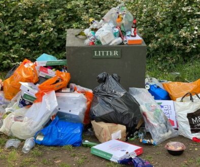
- Littering (e.g. dropped cigarette or reflective items and glass bottles).
- Unattended fires (e.g. campfires, barbecues and bonfires left unattended or not fully extinguished).
- Deliberate fire-setting.
- Controlled burning used to manage land that then gets out of control.
The NFCC also identifies other factors and causes, including:
- Weather conditions (e.g. prolonged high temperatures, low rain and humidity, high winds).
- Natural occurrences (e.g. lightning strikes).
The Ministry of Housing, Communities and Local Government (MHCLG) publishes data on incidents attended by Fire and Rescue Services; however, wildfires is not a category recognised in the current system. Wildfires are recorded as ‘primary outdoor fires’ (those involving either a fatality, casualty or rescue, or attended by five or more pumping appliances) or ‘secondary fires’ (generally small outdoor fires not involving people or property). The latest statistics, for the year ending December 2025 (published in April 2026), show:
- Fire and Rescue Services attended 175,918 fires, an increase of 29% compared with the previous year (136,882) and an increase of 8.4% compared with ten years ago (162,346).
- There were 66,832 primary fires, an increase of 9.3% compared with the previous year, but a decrease of 8.1% compared with ten years ago. However, 7,073 of these were outdoor fires, an increase of 62% compared with the previous year (4,352), and an increase of 36% compared with ten years ago (84,944).
- There were 107,283 secondary fires, an increase of 46% compared with the previous year (73,676) and an increase of 26% compared to ten years ago (84,944).
- In terms of the total fires attended by Fire and Rescue Services in England – these fluctuate between 136,000 and 184,000. The summers of 2018, 2022 and 2025 were hot and dry which caused high numbers of fires in those years, particularly outdoor primary and secondary fires.
The Moorland Association draws on the Global Wildfire Information System (GWIS) and Our World in Data to present real-time wildfire data for the UK. To 10 July 2026, there were 66 wildfires in the UK.
The Forestry Commission (now Forestry England) carried out an analysis of all wildfire incidents attended by Fire and Rescue Services in England between 2009/10 to 2020/21. This shows:
- Year-on-year variation: Fire and Rescue Services attended over 360,000 wildfire incidents in England during this period leading 79,000 hectares of land to burn. The total duration of the incidents was just under 540,000 hours. The greatest number of incidents took place in 2011/12 (47,000) and the greatest area of land burnt by wildfire in 2018/19 (26,000 hectares). Weather conditions are likely to have had a significant impact on the likelihood and severity of wildfire incidents. For example, the months with the greatest area of land burnt include April, July, and June.
- Small size of wildfires: 99.5% of wildfires were small [less than one hectare] in terms of the area of land burnt, with nearly all the rest medium sized [1-49 hectares]. Over the 12 year period, only 45 were large [50-99 hectares], 67 very large [100-999 hectares] and 18 landscape scale [greater than 1,000 hectares].
- Type of land burnt: The greatest area of land burnt by wildfires was ‘mountain, heath and bog’ (over 15,000 hectares), followed by ‘semi-natural grassland’ (nearly 4,700 hectares), ‘improved grassland’ (nearly 6,000 hectares) and ‘built up areas and gardens’ (nearly 5,000 hectares). The overwhelming majority of wildfires in woodland were broadleaved woodland – with the total number of woodland wildfires comprising 14.2% of the total.
- Protected landscapes: 4,700 wildfires in National Parks burnt over 14,000 hectares of land, and 11,000 wildfires on Sites of Special Scientific Interest burnt over 28,000 hectares.
- Region and local authority area: The largest number of wildfires per square kilometre was London, followed by the North East. However, in terms of the area of land burnt, the North West had the most, followed by Yorkshire and Humber and London. Indeed, the greatest number of wildfire incidents per square kilometre were recorded in Fire and Rescue Authorities covering major metropolitan areas. The ten local authorities with the greatest number of wildfire incidents recorded were predominantly urban in nature.
The Global Wildfire Information System (GWIS) is a joint initiative by the Group on Earth Observations – hosted by the UN’s World Meteorological Organization (WMO) – and EU’s Copernicus Earth observation and monitoring programme. According to country profiles, between 2002 and 2024, the burned area in England comprised 855.057 hectares, more than Northern Ireland (308.572) and Wales (313.044) but less than Scotland (3607.160).
Overall, the data indicates considerable year-to-year variation in wildfires, with years of high wildfire damage occurring in 1995, 2002, 2011, 2019 and 2025. The data also demonstrates clear seasonality, with wildfires peaking in spring when there is dry, dead ground vegetation, and again in the summer during hot and prolonged dry periods. However, some of the data collection only covers wildfires exceeding a set number of hectares (i.e., GWIS maps wildfires of 30 hectares or larger although this may also include the perimeter of burned areas of smaller dimensions; the threshold is 1 hectare for NFCC operational guidance) or that Fire and Rescue Services attended. Similarly, the trends by land cover and different vegetation types are more difficult to ascertain, with much of the official data covering forests, savannahs, shrublands, grasslands and croplands. Moreover, wildfire trends are difficult to track because wildfires are often classified within other fire categories. While the likelihood and impact of wildfires will vary greatly across landscapes, in the UK, data and evidence have primarily focused on forests and uplands; and while there is some data on agricultural land, it largely focuses on arable (both cut and standing crops), with little specific information available for other categories of rural land.
According to the NFCC, wildfires are ‘starting earlier in the season and typically lasting longer due to prolonged higher temperatures than the historic average. We are increasingly finding that wildfires can now occur almost anywhere in the country and are impacting on all Fire and Rescue Services’. They also note how responding to wildfire incidents is: ‘[…] not a specifically funded capability and falls into the general FRS duty to extinguish fires. As such, costs associated with the development of capabilities and capacity to fight wildfires is currently drawn from FRS core budgets, which are being cut in real terms. FRS are reliant upon tactical advisors coordinated through NFCC National Resilience, however, national assets and further resources for FRS are limited’.
A report from the United Nations Environment Programme (UNEP) and GRID-Arendal, has projected that climate change and land-use change will make wildfires more frequent and intense, with a global increase of extreme fires of up to 14% by 2030, 30% by the end of 2050, and 50% by the end of the century. The report highlights a focus on ‘wildfire-watershed risks to large cities’ rather than smaller and rural communities (page 65). In the UK, the Climate Change Committee (CCC) also highlights ‘unequivocal evidence that climate change is making extreme weather in the UK, such as heatwaves, heavy rainfall, and wildfire-conducive conditions, more likely and more extreme’ and that the hot and dry conditions in summer 2022 ‘led to an unprecedented number of wildfires, with many Fire and Rescue Services declaring major incidents in July 2022 following a 500% increase in 999 calls’ (page 11). Indeed, analysis from the Met Office, the Centre for Ecology & Hydrology and the University of Exeter, reveals at least a 6-fold increase in the probability of very high fire weather in the UK due to human influence, most of which is driven by high fire conditions across England. The CCC also points to how ‘these [wildfires in summer 2022] occurred in urban as well as rural areas and posed significant challenges to emergency services responding to fire instances…On 19 July 2022 [the hottest day on record in the UK] a large wildfire in East London destroyed 16 homes’. In a parliamentary debate on wildfires in June 2025, Lord Bailey of Paddington described how “things have now become so bad that the urban-rural interface encroaches on London…There is a continuing saga of blame being passed around: the local council is not the landowner, so it thinks the landowner should take charge; meanwhile, the landowner believes that the Mayor of London should take charge. The locals believe that somebody should take charge because they are suffering”.
Wildfires in the UK are becoming more widespread, starting earlier, lasting longer, and now affecting both rural and urban areas, with global and UK projections are showing large increases in wildfire events. These shifts mean communities, businesses and service providers face a higher fire risk and a broader set of consequences than they have previously had to plan and prepare for – raising issues around what this changing threat means for rural areas, and how they can respond.
What do wildfires mean for rural communities, economies and landscapes?
The Parliamentary Office of Science and Technology (POST) identifies five threats posed by wildfire:
- Biodiversity: Wildfire kills organisms that move too slowly to escape and alters post-fire habitat composition. Changing fire regimes can alter ecosystems by promoting species that better tolerate fire, at the expense of fire-sensitive species.
- Carbon emissions and climate change: Global wildfires emitted 2.2 Pg C yr-1 between 1997 and 2016,c compared with an average of 30 Pg C yr-1 over the same period for fossil fuels and industry. Wildfires have complex effects on soils, vegetation and the atmosphere which may increase or partially offset the climate impacts of wildfire greenhouse gas emissions.
- Soil and water: Wildfire removes surface vegetation and alters soil properties. This means rainfall reaches watercourses faster in subsequent storms, exacerbating flooding. Eroded sediment enters watercourses, reducing water quality.
- Human health: Wildfires present hazards which may injure or kill emergency responders and members of the public. Exposure to wildfire smoke can cause respiratory and cardiovascular health impacts over great distances. Wildfires can increase the prevalence of mental health conditions in impacted communities. In July 2026, smoke from more than 800 wildfires in Canada and Minnesota triggered air quality alerts across at least 17 states, demonstrating how health impacts can extend far beyond the area that burns.
- Economic: Wildfires affect economies through capital losses, disruption to economic activity and health effects. Economic losses from Californian wildfires totalled approximately $148.5 billion in 2018, equating to 1.5% of California’s GDP.
The Moorland Association has collated research to highlight the financial consequences of wildfires:
- UK Government bodies such as Defra and the Home Office alongside agencies like Scottish Fire & Rescue Service, calculate costs by summing up direct expenditures and losses and then dividing by the burnt area to get an average cost per hectare. This focuses on tangible costs including emergency response (i.e., Fire and Rescue Service deployments) and immediate damage to property. Alongside this, Forestry England and Natural England highlight ecosystem losses (e.g. carbon released, habitat destruction) and assign monetary values – for example, the Saddleworth Moor fire burned deep peat, releasing approximately 40,000 tonnes of CO₂ which can be monetised. Similarly, the costs borne by public bodies to fight the fire can also be quantified – for example, the Winter Hill wildfire in 2018 cost £1.2 million in Fire and Rescue Services expenses.
- Academic studies take a broader view, incorporating environmental and health impacts alongside direct costs. Researchers have developed frameworks to identify both suppression costs and wider societal damages. Researchers have estimated that Fire and Rescue Services response costs for wildfires across the UK are approximately £55 million per year – for example, at a single, large moorland firefighting costs can reach up to £1 million. The WWF (World Wide Fund for Nature) has highlighted that degraded peat and lost carbon storage are major hidden costs. Other studies have worked with land managers to understand the costs of restoring a landscape after a fire (e.g. controlling erosion, reseeding vegetation, replanting trees, rewetting peatlands).
- The insurance industry focuses on property and agricultural losses – with NFU Mutual reporting £83.5 million in farm fire claims during the 2022 drought. Agricultural productivity losses in summer 2018 were estimated at £32 million. Farm insurance claims for fire damage in Scotland during 2018 increased by approximately 20% from 2017 – with data also indicating that long term lending to Scottish agriculture did not increase over that period and anecdotal evidence suggesting a loss of grazing forage. More recently, NFU Mutual’s Farm Fires Report (2025) reveals the cost of farm fires was estimated at £102 million in 2024 – and the leading causes electrical faults, arson and lightning strikes. Hannah Binns (NFU Mutual) describes how “fire remains a constant risk to UK farms, with dangerous and devastating farm fires becoming all too common. These fires not only endanger the lives of farmers, farm workers and their families, but can destroy months or years of hard work, with lasting consequences for agricultural businesses structurally and financially…Farm fires can also cause disruption to local communities, damaging essential infrastructure such as power lines and overhead cables, and causing road closures that interrupt vital services”.
An analysis of carbon emissions from the UK’s first megafire – the 2025 Dava Moor fire in Scotland – led by the University of East Anglia found the fire ‘emitted over 140 thousand tonnes of CO2 to the atmosphere. To recover that amount of carbon, you would need to plant forest on 425 football pitches and that would cost in the region of £3 million’. A report from Scottish Land & Estates for the Scottish Government (July 2025) collated information about the response, revealing how:
- Rural businesses contributed 34 ATVs, 27 fogging units, 9 tractors, 5 diggers, 5 water diggers and 50 leaf blowers to the containment and suppression effort. The estimated value of this equipment was £3.1 million.
- 18 businesses recorded damages ranging from £50 to £5,000.
- Of 101 rural dwellers engaged in the containment effort, 80 employees had experience of using fire in the course of managing land.
- Businesses said that the Fire and Rescue Services response could have been improved by ensuring access to appropriate equipment to tackle wildfires in difficult terrain. Businesses also noted that the response from the land management community could be improved by underscoring the importance of fuel load management and fire breaks, both in terms of preventing wildfires and enabling more effective containment and suppression.
- Other suggestions from businesses included helping Fire and Rescue Services to build better situational awareness of locally available resources, the strategic placement of water and equipment, strengthening the Scottish Outdoor Access Code, and a targeted grant scheme to assist rural businesses to invest in counter-wildfire capabilities.
Fire and Rescue Services data shows that secondary fires have a slower response time than primary fires as most of these locations are ‘outdoor, more rural and have a lower risk to life or property’. In the year ending March 2025, average response times to primary fires increased, most notably in rural Fire and Rescue Authorities (FRAs): ‘The crew turnout time and drive time both increase for more rural FRAs compared to urban FRAs, likely reflecting the crew type (generally more on-call firefighters in rural FRAs) and the distance to incidents.’
The evidence shows that wildfires trigger a cascade of environmental damage, major carbon losses, degraded soils and water, health impacts, and place a significant financial strain on those who live and work in the countryside. However, the true burden is far larger than the burnt land itself, with wider, longer‑lasting emotional and environmental consequences that are harder to measure and whose knock‑on effects continue long after the flames are out.
How prepared are we?
Wildfire risk is at its greatest at sites where there are potential sources of ignition on-site or nearby, habitats with a high fuel load, and assets at risk on site or nearby (e.g. people, buildings, infrastructure, priority habitats and species, historical features or significant carbon stocks). Responsibility for managing wildfire risk is devolved across the UK, with policies and approaches varying by country.
“It was a Sunday afternoon when I received the call. A local farmer informed me of a fire on Thorne Moors, part of the Humberhead Peatlands…the size of the area that was affected: about 70 acres. We had nine fire engines on site from a number of local stations across the area – engines that should have been parked up waiting for any other emergency calls…We then learnt that some locals had been racing quad bikes on the boundary the previous day and it was likely that the hot exhausts may have triggered dry bracken to light up in flames. It took a team effort of three weeks to put the fire out. Tens of fire and rescue personnel, local contractors and farmers, pumps on hire to move water to the fire site, hundreds of metres of pipe, equipment form several other National Nature Reserves and lots of blood, sweat and tears”, Natural England advisor.
In England, the Ministry of Housing, Communities and Local Government (MHCLG) oversees Fire and Rescue Services, and the Department for Environment, Food & Rural Affairs (Defra) reviews land management and promotes wildfire mitigation and adaptation planning. The Cabinet Office is responsible for the National Risk Register which sets out how Fire and Rescue Services are expected to plan for foreseeable risks from wildfires in their area through their Integrated Risk Management Plan (IRMP) – now transitioning to Community Risk Management Plans (CRMP). In addition, MHCLG works with the National Fire Chiefs Council (NFCC) to understand the changing risk and to improve prevention of and response to wildfires – however, Fire and Rescue National Framework documents published in 2008, 2012 and 2018 do not explicitly reference wildfires, and nor do recent annual assessments of Fire and Rescue Services in England produced by His Majesty’s Inspectorate of Constabulary and Fire & Rescue Services (HMICFRS).
What is being done to prevent or reduce wildfire ignitions?
The UN Environment Programme (UNEP) has been calling for a radical change in Government spending on wildfires, shifting their investments from ‘reaction and response’ to ‘prevention and preparedness’. Examples in a UK context include:
- Analysing real-time weather data to determine how these could affect fire behaviour: The Met Office produces the Fire Severity Index (FSI) to evaluate how severe a wildfire could become if one were to ignite under current weather conditions. Upon request, they also produce extended outlooks working with the National Hazards Partnership (NHP) to support Government on long-term wildfire conditions across the UK. During an incident, they also support responders with FireMet [a weather system for Fire and Rescue Service responders] and Chemical Meteorology service (CHEMET) which provides meteorological guidance and a plume prediction.
- Analysing human behaviour – public engagement and campaigns: The Countryside Code urges visitors to take their litter home and leave no trace of their visit, to not light fires and only have barbeques where signs say you can, and to care for nature – avoiding causing damage or disturbance. A Behavioural Research UK (BR-UK) study for the Government Office for Science (Go-Science) highlights how visitors to the countryside frequently engage in activities without understanding local restrictions or the fragility of rural landscapes. They suggest that public messaging in the countryside is currently inconsistent, with different land owners, local authorities and agencies giving different advice leaving people unsure about what is allowed and where; and they recommend more visible and unified communication is essential to influence behaviour in rural areas. In Wales, the Healthy Hillsides Project aims to increase understanding of the wildfire cycle, and how actions can reduce or increase risk. During periods of heightened fire risk, Fire and Rescue Services issue public warnings urging people to avoid activities that could cause ignitions, such as wildfire alerts in North Wales and Devon & Somerset in summer 2026.
- Rural communities preparedness: Devon & Somerset Fire & Rescue Service provides wildfire advice for people living in rural areas – with guidance covering creating a safety zone around your home and how to help Fire and Rescue Services find your property. There is also broader prevention advice covering farms and how to report irresponsible behaviour. Similarly, the Firewise initiative in Dorset which encourages residents to reduce their risk by taking practical steps in the area around their home and garden.
- Land management: In July 2026, the Rural Payments Agency (RPA) launched a new round of Capital Grants – this includes funding for farmers to create a wildfire checklist, supporting mapping and the identification of risks on their land (£327.12 per checklist). This comes on top of existing grants including the Countryside Stewardship Higher Tier (CSHT) scheme which provides funding for farmers to maintain firebreaks or fuel breaks (£137 per hectare per year) and fire belts (£861 per hectare, per year) to help slow or stop the progress of wildfires. The Heather and Grass etc. Burning (England) Regulations 2007 and 2021 were amended through The Heather and Grass etc. Burning (England) (Amendment) Regulations 2025 which has strengthened legislation to help restore and rewet wetlands. It prohibits the burning, without a licence, of specified vegetation on peat over 30 centimetres in depth on all land within Less Favoured Areas (LFAs). It aims to protect 676,628 hectares of peatland habitat by preventing further damage from burning. However, the Moorland Association brought a case calling for a judicial review of the new regulations because they believe they are legally flawed, practically damaging and environmentally short-sighted. While the case was unsuccessful, the organisation is calling on members to provide practical examples about how the licensing system is working, what the obstacles are, and what outcomes are being reached. Also in 2025, Defra and Natural England updated The Heather and Grass Management Code, this is a voluntary code that outlines good practice on planning the management of vegetation, including when and where to carry it out safely and responsibly.
- Restoring and improving habitats and ecosystems: Natural England promotes nature recovery as the best tool against heightened wildfire risk and that restoring habitat condition (e.g. rewetting peat) as reducing the risk and severity of wildfires over the long-term. It cites how in 2023, after a significant period of drought, Marsden Moor in West Yorkshire suffered seven wildfires over a tenth of the 2000-hectare estate. While drier areas continued to smoulder, restored wet areas with Sphagnum mosses acted as firebreaks to limit the spread of the fire. They describe how: “Not only does this type of nature restoration help to combat the threat of fires, it brings a host of other benefits too. The soil holds carbon underground instead of releasing it into the atmosphere where it contributes to climate change. At the same time it retains water, improving water quality while mitigating the impacts of droughts and floods – all with positive advantages for businesses and the bills and insurance premiums their customers pay. In addition, the landscape provides more habitat for wildlife and more places for people to visit and enhance their mental and physical health”. Since 2021, Natural England and Defra have been running a Nature for Climate Peatland Grant Scheme (NCPGS) which funds landscape scale interventions that work to restore the whole hydrological unit of a peatland. For example, in June 2026 it was announced that up to £3.2 million would be awarded to the North York Moors National Park Authority to repair 17 kilometres of firebreaks, stabilise damaged slopes, restore key peatland species and public rights of way damaged by the Fylingdales wildfire in summer 2025.
How well equipped are we to suppress wildfires?
- National resilience: Fire and Rescue National Resilience provides specialist capabilities, personnel and resources which enhance the ability of the Fire and Rescue sector to respond effectively to large-scale or critical incidents. Merseyside Fire and Rescue Service is the designated lead authority on behalf of the MHCLG. Incidents supported by National Resilience capabilities include north-west wildfires, and the Chobham Common wildfires.
- Training for Fire and Rescue personnel: Through Wildfire Aware, the NFCC provides members with training courses and other support to equip Fire and Rescue Service personnel to promote consistent response and suppression practices, facilitate cross-border mutual aid, and ensure safe systems of work. This builds on the Wildfire Prevention Toolkit which covers risk, education, prevention and preparedness. However, there are no mandatory standards for the provision of wildfire-specific training and equipment, meaning capacity and expertise varies across Fire and Rescue Services. Large wildfires in the Cairngorms and Derbyshire during summer 2026 required extensive multi-agency responses, underlining the scale of resources now needed to suppress major incidents. Furthermore, UK fire investigators are not routinely trained in wildfire investigation – affecting data collection and targeted action to reduce negligent or deliberate ignitions.
- Training for landowners, managers and researchers working in forestry, conservation, game management, agriculture, rural and urban land management: Lantra offers accredited fire management courses designed by Forestry England. It includes modules on vegetation fires, the management of prescribed burning as part of vegetation management, and planning the management of fire operations.
- National, regional and local wildfire groups: The England and Wales Wildfire Forum (EWWF) is a multi-agency stakeholder group of public, private and voluntary and community sector organisations which work to address wildfire issues. The EWWF and Moorland Association worked together to develop a short training course for land managers who may find themselves working alongside Fire and Rescue personnel at wildfires. While the EWWF focuses on national wildfire issues, they also work with 14 regional and local groups to promote cooperation and collaboration. The EWWF also collects case studies of wildfire incidents and good practice – including from Dorset, Northumberland, South East England and Staffordshire.
- Greater protection against farm machinery fires: NFU Mutual is recommending fitting fire suppression systems to high-risk kit such as combine harvesters, and they offer a discount to policyholders who have combined with the approved fire suppression kits installed.
Alongside this existing work, there have been calls to undertake further work to mitigate the impact of wildfires. This includes:
- Investing in Fire and Rescue Service capacity: In November 2025, the Fire Brigades Union (FBU) and environmental groups wrote to the Chancellor and Environment Secretary calling on the Government to provide significant new funding for Fire and Rescue Services to ensure sufficient and specialist resources to meet wildfire and flooding risks and develop a UK-wide wildfire resilience strategy.
- Developing a new fire hazard assessment system tailored to fuel types: Building on the work of the Met Office’s Fire Severity Index (FSI), academics have called for the development of a Fire Danger Rating System (FDRS) – this is based not only on meteorological data, but also the location and condition of fuels, which allows for a tailored UK fire behaviour model to be produced (e.g. allowing for management decisions to be taken in advance of heightened fire conditions, such as stepping up additional Fire and Rescue Service crews). In January 2025, Forestry England said it was “awaiting confirmation of funding [from Defra and the Home Office] to progress the UK fire danger rating system, to develop a wildfire risk map and to analyse post-2021 wildfire statistics”.
- Fire management: Landowners and managers play a crucial, preventative role, but their expertise if often undervalued and excluded from official wildfire planning. In a current case, David Livesey, a grouse moor owner, is suing United Utilities for more than £1 million compensation, claiming the company did not taken reasonable steps to prevent third parties from coming onto his land from lighting fires from a portable barbecue and then failing to stop its spread across 630 acres of land on Darwen Moor. Mr Livesey describes how “They [United Utilities] are a huge organisation with a large firefighting presence. So on Saturday evening, for them to show up but not use any of their staff or equipment is just not right…thousands of animals were killed, including many rare red-listed species like short-eared owls, curlew, and golden plover…Because of the time of year, the chicks were too young to fly or hadn’t yet hatched. An entire generation of wildlife was wiped out”.
- Building the evidence base and good practice: As part of the Environment, Food and Rural Affairs Committee’s climate and weather resilience work, in April and May 2026, the Committee ran a call for evidence on the growing threat posed by wildfires in both urban and rural areas in the UK, seeking information on how risks are mitigated through land management and monitoring, and which organisations and Government agencies should have responsibility and oversight of these efforts. As part of its work, the Committee is now looking at how other countries prepare and mitigate wildfire risks.
Some examples of good practice from other countries include the Portuguese Integrated Rural Fire Management System which includes a National Plan for Integrated Rural Fire Management (NPIRFM) and is underpinned by four strategic goals to value rural areas, the active management of rural areas, and efficient risk management. The NPIRFM contains targets around the loss of human lives in fires as a rare occurrence, that fires spanning over 500 hectares only account for 0.3% of total fires, and the accumulated burn areas between 2020 and 2030 is less than 660,000 hectares. While the United States Department of Agriculture (USDA) administers the Community Wildfire Defense Grant (CWDG), a programme which provides funding to communities at risk from wildfire to develop or revise their community wildfire protection plans and carry out mitigation projects described within those plans, announcing in September 2025, that it was investing $200 million in 58 projects. More recently, in Spain, the government has launched a forest fire prevention campaign (2026) and is increasing firefighting kit and aircraft, high capacity drones, all-terrain vehicles, thermal cameras and advanced surveillance and tracking systems. All of this builds on the Spanish government’s strategic guidelines and the work of forest fire reinforcement brigades (BRIF). If community engagement may reduce wildfires, what can we learn from these examples to support rural communities across the UK?
Where next?
The UNEP is calling on Governments to adopt a ‘Fire Ready Formula’, with two-thirds of spending dedicated to planning, prevention, preparedness and recovery, and one-third left for response. Yet UNEP analysis shows that direct responses to wildfire typically receive over 50% of related expenditures, while planning receives less than 1%.
The level of awareness and engagement with wildfire risk is currently variable in England. Back in July 2023, the Government committed to scoping out a Wildfire Strategy and Action Plan – with Defra, its agencies and National Landscapes supporting the Home Office to do this by mid-2024. Similarly, Forestry England is awaiting confirmation of funding to progress a Fire Danger Rating System. Meanwhile, although wildfire has been included in some strategic plans since then, including those covering climate change, forestry, and vegetation management, the Land Use Framework for England (March 2026) contains just one reference: ‘By 2030, nature-based solutions will be delivered at pace to support landscape-scale adaptation to and mitigation of climate change impacts. This will include restoring the peatlands, coastal habitats and wetlands that store carbon and reduce flood and wildfire risk to homes, infrastructure and nature, and increasing tree canopy cover vital for reducing urban overheating’ (page 15).
All of this raises important questions: do we need a National Wildfire Strategy, and if so, will it identify those rural assets and locations most at risk so that plans can be put in place before a wildfire occurs? Will the forthcoming Land Use Framework Delivery Plan utilise land management techniques at local and regional levels while balancing the needs of different land owners, managers and users? The Climate Change Committee has noted that there has been “little data on the number of properties at risk of wildfires in England, and no data on building-level measures to help manage wildfire risk” (page 76). How can rural evidence gaps be filled? Crucially, what resources and support do rural businesses and communities need to respond to an increasing number of wildfires – especially given that secondary fires in rural, outdoor areas, often have slower response times due to distance and on-call staffing? Experience elsewhere suggests the challenge will intensify. During the 2026 wildfire season, emergency services across parts of southern Europe faced difficult decisions about where limited firefighting resources should be deployed as multiple, large incidents occurred simultaneously. In May 2026, a new All-Party Parliamentary Group (APPG) on wildfires was set up, will the group pick up the baton on all of this? While wildfires also pose a serious threat to urban areas, can more be done to prevent, prepare and protect rural residents? Watch this space.